
It is easy and takes a couple of steps to start working with the Dashboard.
1. Create an account
Please create your account by signing up with your email on Dashboard. If you are already registered for Agro API, there is no need to create a separate account and you can use your current login and password to sign in.
2. Create a polygon
After your successful registration, you will see the start page of Dashboard. Basically, this page shows the list of all your created polygons, but as a new user, you have only a test polygon (you can delete it at any time).
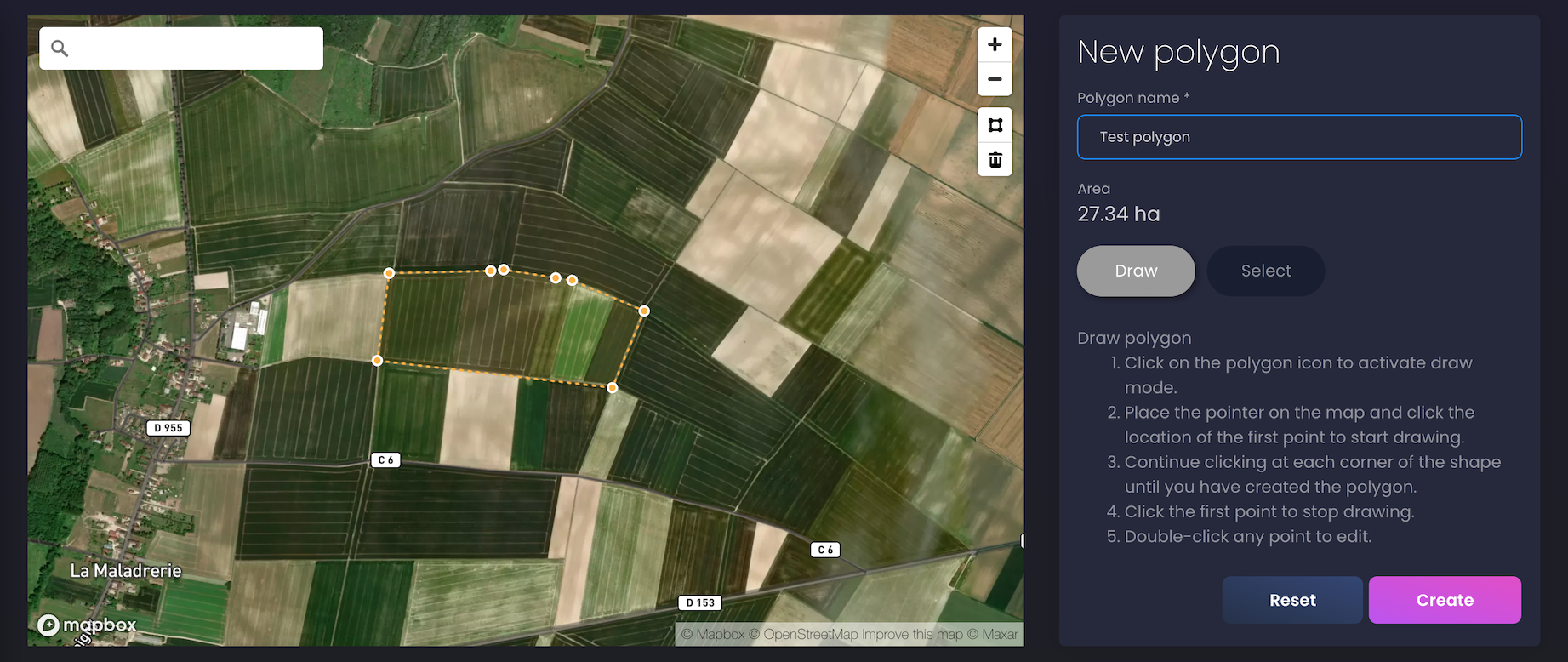
To create your own polygon you can click the "Create polygon" button on the current page or click on the "New polygon" left menu item.
You have 2 ways to create your polygon:
-
Draw a polygon manually. Select the "Draw" button on the right-hand panel, then click on the polygon icon on the map to activate draw mode. Place the pointer on the map and click the location of the first point to start drawing. Continue clicking at each corner of the shape until you have created the polygon. Click on the first point to finish the polygon.
-
Find a polygon on the map. To find your polygon on the map with already recognized boundaries of polygons, please select the "Select" button on the right-hand panel and click on a recognized polygon to select. If you want to edit the boundaries of your polygon then click on the chosen polygon again and shift the polygon's corners.
Fill in the "Polygon name" field and click the "Create" button to save your polygon.
Congratulations! Now you can find satellite and weather data for your polygons. Please visit our Documentation to learn how to do it.
If you have any questions or comments, please contact us at info@openweathermap.org.